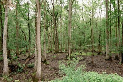
About: Donnelley WMA is managed to provide optimum habitat for a wide variety of wildlife and to provide public recreation and education. The area has two designated nature trails and miles of dirt roads for hikers and bicyclists. Late winter through early spring provides bird-watching opportunities to observe a variety of species including waterfowl and migratory songbirds. Alligators are abundant in the managed wetlands and are most often seen from late February through mid-November. Hunting opportunities are available to the public for white-tailed deer, wild turkey, waterfowl, dove, small game and furbearers. A Driving Tour of the area provides excellent wildlife viewing opportunities for those who are mobility impaired. The unique property is a cross section of the Lowcountry and encompasses a diversity of wetland and upland habitats including: managed rice fields, forested wetland, tidal marsh, agricultural lands and a variety of upland types, including a natural stand of longleaf pine.
Donnelley Wildlife Management Area is a good companion to nearby Bear Island Wildlife Management Area. Donnelley has more woods—upland hardwood forests, pine forests, and hardwood swamp forests, and it also has some good freshwater marshes and swamps. Some species, such as woodpeckers, warblers, Black-bellied Whistling-Duck, and Purple Gallinule, are much more likely at Donnelley than at Bear Island.
There are three principal roads at Donnelley—Main Road, which starts at US 17 and runs mostly south to a T-junction with Blocker Run Road, Blocker Run Road, which runs west from Bennetts Point Road all the way through to the western edge of the area at Stocks Creek Road, and the road to the lodge, which starts at Main Road and goes generally southwest until it joins Blocker Run Road. Each of these roads passes a variety of marshes and impoundments that may have good birds. In addition there are a number of other roads criss-crossing the area, some of which are open to vehicles, others of which may be walked. Some of these side roads, such as Ball Bank Road, which goes west from Main Road in the central part of the area, lead to interesting marshes. There is also a 3-mile loop nature trail (Boynton Nature Trail).
Donnelley WMA is named in honor of the late Gaylord Donnelley and his wife Dorothy for the contributions they made to the ACE Basin Project and conservation across the continent. Donnelley WMA is owned and managed by the South Carolina Department of Natural Resources. Ducks Unlimited, The National Wild Turkey Federation, US Army Corps of Engineers, The Nature Conservancy and other conservation interests participated in establishing the property.
Location: The main entrance to Donnelley Wildlife Management Area is along US 17 near Green Pond. Turn south from US 17 about 100 yards northeast of the junction of US 17 and SC 303. If you are coming from Bear Island Wildlife Management Area, go north on Road 26, Bennetts Point Road. Look for Blocker Run Road, the eastern entrance road for Donnelley, about 6 miles north of the bridge over the Ashepoo River on the north side of Bear Island. Donnelley is closed on Sundays and during special hunts.
Links: https://public-lands-scdnr.hub.arcgis.com/pages/donnelley-wma - for driving tour https://dnr.sc.gov/gis/docs/donnelleydrivingbroc.pdf